Business Details
Expert Land Surveying Services in Gawler
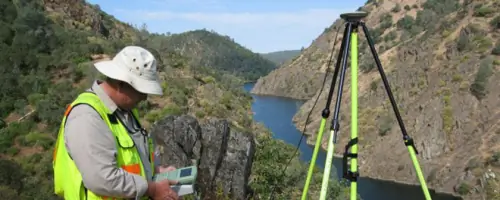
Bleeze Neale & Associates is a South Australian land surveying consultancy with 30 years of experience delivering precise and reliable surveying solutions. Our team serves private, corporate, and government clients across property and engineering surveys, utilising advanced robotic and GPS technology for fieldwork and sophisticated software for digital outputs. We specialise in boundary identification, land division, engineering surveys, lease plans, and development applications, ensuring compliance with regulatory standards. Our consultants provide end-to-end support from project conceptualisation to certification by licensed surveyors. With offices in Gawler and Morphett Vale, we combine local expertise with statewide reach to meet diverse client needs.Our commitment to accuracy is demonstrated through detailed contour mapping, encroachment checks, and easement management. We maintain transparency in all processes, including boundary re-marking for construction projects and fence installations. Our team stays current with industry advancements to deliver efficient, technology-driven solutions. Clients benefit from our extensive experience in navigating land title office requirements and subdivision approvals. We prioritise clear communication and certified documentation to ensure client confidence in every project outcome.
Services
Boundary Identification Survey
Land Division Survey
Engineering Surveys
Lease Plan Preparation
Development Applications
Construction Set-Out
Easement Management
Highlights and features
- We offer 30 years of specialised land surveying expertise across South Australia
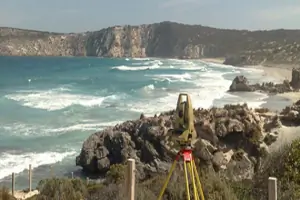
- Our team utilises advanced robotic and GPS instrumentation for precise measurements
- All surveys are certified by licensed professionals ensuring regulatory compliance
- We provide end-to-end project support from conceptual planning to final certification
- Our consultants have extensive experience with both private and government clients
Services
Boundary Identification Survey
Our boundary identification surveys precisely mark property lines using historical records and modern GPS technology. This service helps clients resolve encroachment issues, plan constructions near boundaries, and prepare for fence installations. Licensed surveyors conduct field measurements and produce certified plans for legal documentation.
Land Division Survey
We specialise in land division projects ranging from minor boundary adjustments to large-scale subdivisions. Our consultants advise on appropriate division methods, manage agency approvals, and ensure compliance with title office requirements. The service includes plan preparation and certification for new certificate of titles.
Engineering Surveys
Our engineering surveys capture contour, level, and feature data for residential and commercial developments. Using advanced instrumentation, we deliver digital files and CAD plans tailored to client specifications. This service supports infrastructure planning, shopping centre design, and road construction projects.
Development Applications
We prepare survey documentation for development applications including boundary overlays and underground service mapping. Our team ensures compliance with regulatory standards and provides accurate spatial data to support planning submissions for residential and commercial projects.
Easement Management
We create, vary, or extinguish easements through precise surveying and plan preparation. This service covers infrastructure rights-of-way, party walls, and above/below ground easements, ensuring proper documentation and certification for property title modifications.
Questions
What surveying services do you offer?
We provide boundary identification, land division, engineering surveys, lease plans, development applications, construction set-out, and easement management services.
Do you work with both private and government clients?
Yes, we serve private individuals, corporations, and government agencies across residential, commercial, and infrastructure projects.
How do you ensure survey accuracy?
We use robotic and GPS instrumentation combined with digital mapping software, with all surveys certified by licensed professionals.
Are your surveys legally valid?
Yes, all our surveys include certified plans prepared in accordance with Lands Titles Office requirements.
Do you operate statewide?
We have offices in Gawler and Morphett Vale, providing services across South Australia.