Business Details
Your Trusted Surveying Partner in Byron Bay
Established with over 30 years of combined experience, Byron Bay Surveying has evolved into a leading surveying firm in the Northern Rivers region of New South Wales. Our team of seasoned professionals utilises cutting-edge 3D technology and advanced equipment to deliver precise, reliable data for residential, commercial, and government projects. We pride ourselves on transparent communication, meticulous attention to detail, and a commitment to continuous professional development, ensuring we remain at the forefront of industry advancements.Our services span property surveys, construction setout, land development, and infrastructure monitoring, supported by a deep understanding of local and regional planning requirements. With offices in Byron Bay and Alstonville, we serve projects across NSW and Queensland, prioritising client needs while contributing to the sustainable growth of our community. Our dedication to health and safety, coupled with our use of innovative techniques like laser scanning and drone mapping, ensures minimal risk and maximum accuracy for every project.
Services
Property Surveys
Construction Surveys
Land Development
Aerial Surveys
Topographical Surveys
Monitoring Services
Measured Building Surveys
Hydrographic Surveys
Boundary Marking
Level Certification
Highlights and features
- We utilise advanced 3D technology and laser scanning for accurate data collection.
- Our team has over 30 years of combined experience in land surveying.
- We provide tailored solutions for residential, commercial, and government projects.
- Registered statewide in NSW with expertise in local planning regulations.
- Committed to health and safety, minimising risks during all surveying operations.
Services
Property Surveys
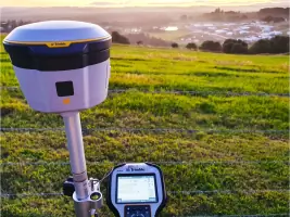
We conduct detailed property surveys including boundary marking, title definitions, and identification surveys. Our services ensure compliance with NSW planning regulations and provide accurate data for property transactions or development. Utilising GPS and laser technology, we deliver precise measurements to support informed decision-making for residential and commercial clients.
Construction Surveys
Our construction surveying services cover setout for buildings, pipelines, and infrastructure projects. From small residential works to high-rise developments, we ensure alignment with design specifications using advanced 3D modelling and machine alignment techniques. This guarantees structural integrity and compliance with engineering standards throughout the project lifecycle.
Land Development
We facilitate land development projects including strata subdivisions and community title developments. Our team manages legal requirements, coordinates with councils, and establishes body corporate frameworks. This service supports urban, rural, and commercial projects, ensuring adherence to zoning laws and infrastructure planning.
Aerial Surveys
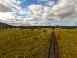
Using drones and LiDAR technology, we perform aerial surveys for topographical mapping and infrastructure assessment. This method provides high-resolution data for large-scale projects like rail trails and flood-affected areas. It enables efficient analysis of challenging terrains while maintaining safety and accuracy.
Monitoring Services
We offer monitoring solutions for infrastructure movement and environmental changes. By deploying precision instruments, we track shifts in buildings, bridges, and natural landscapes over time. This service is critical for assessing structural health and ensuring long-term safety in construction and environmental management projects.
People
Bill Nagel
Director
With decades of experience in land surveying, Bill Nagel leads Byron Bay Surveying's operations. His expertise in construction and infrastructure projects ensures clients receive accurate, compliant solutions tailored to their needs.
Lucas Flumm
Surveyor
Lucas Flumm specialises in engineering and construction surveys, bringing technical precision to projects across Northern Rivers. His focus on client collaboration ensures clear communication and practical outcomes for complex developments.
Questions
What surveying services do you offer?
We provide property surveys, construction setout, land development, aerial mapping, and infrastructure monitoring. Our services cater to residential, commercial, and government clients across Northern Rivers and beyond.
Are you licensed to operate in NSW and Queensland?
Yes, we are registered in NSW and licensed to provide surveying services throughout New South Wales and Queensland, adhering to local planning and regulatory standards.
How do you ensure survey accuracy?
We use advanced 3D technology, GPS, and laser scanning to guarantee precision. Our team's expertise and adherence to industry best practices ensure reliable data for every project.
Can you assist with urgent surveying needs?
While we prioritise thoroughness, we accommodate time-sensitive projects by coordinating efficiently and deploying resources promptly to meet client deadlines.
What areas do you service?
We primarily serve the Northern Rivers region of NSW, including Byron Bay, Alstonville, and Casino. Our services also extend to other parts of NSW and Queensland.
Reviews (2)
Jody Kalpenos
Oct 29, 2019
Report
Bill was professional from the first time we contacted him. He was polite, on time, calm and clear in his communications. He understood the requirements and delivered on what he agreed to do. Would highly recommend him and his services to anyone.
Philippe Soria
Sep 01, 2019
Report
Bill was available promptly and supplied a very detailed and accurate plan of our Byron Bay property.