Business Details
Expert Geotechnical Mining Engineering Solutions
Dempers & Seymour Pty Ltd is a specialist mining geotechnical and engineering consulting firm dedicated to delivering practical, client-focused solutions. With expertise in open pit and underground mine planning, bankable feasibility studies, and 3D geotechnical rock mass modelling, we provide on-site advice, training, and advanced design tools tailored to client needs. Our team innovates through unique methodologies to quantify and model the 3D variability of geotechnical environments, ensuring precise mine design and planning. We prioritise data-driven decision-making, leveraging geotechnical logging, televiewer interpretation, and drone photogrammetry to optimise operational efficiency. Our services extend to slope stability analysis, dilution rating systems, and hydraulic radius modelling, supporting clients in achieving safe, cost-effective mining outcomes.With a focus on continuous improvement, we integrate stress analysis, structural mapping, and back-analysis of failures to enhance ground support strategies. Our commitment to technical excellence is reflected in published works and proprietary tools like the Mining Rock Mass Model (MRMM) and Rock Bridge Ratio (RBR) design methodology. We serve clients across exploration, feasibility, and production phases, offering customisable solutions that adapt to site-specific conditions. By combining field data with advanced 3D modelling, we empower clients to make informed decisions that balance operational demands with geotechnical risks. Our approach ensures alignment with industry standards while addressing the evolving challenges of modern mining operations.
Services
Mining Rock Mass Model
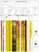
Geotechnical Televiewer Interpretation
Dilution Rating System
Rock Bridge Ratio Design
Drone Photogrammetry
Hydraulic Radius Model
Highlights and features
- We offer proprietary tools like the Mining Rock Mass Model (MRMM) for precise 3D geotechnical analysis.
- Our team specialises in slope stability and dilution rating systems tailored to site-specific conditions.
- We reduce drilling costs through advanced televiewer interpretation and drone photogrammetry.
- Our methodologies are validated in peer-reviewed publications and real-world applications.
- We provide customisable solutions integrating stress analysis and structural mapping for optimal mine design.
Services
Mining Rock Mass Model
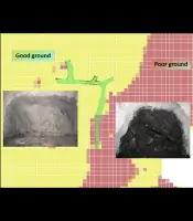
The Mining Rock Mass Model (MRMM) is a dynamic tool for collecting, analysing, and presenting geotechnical data in three dimensions. It integrates structural and geotechnical parameters to enhance mine design accuracy, enabling spatial interrogation of rock mass properties like strength and fracture frequency. Customisable to client needs, MRMM improves confidence in feasibility studies and optimises resource utilisation.
Geotechnical Televiewer Interpretation
Geotechnical Televiewer Interpretation (GTI) uses downhole surveys to evaluate rock mass properties and structural characteristics. This method reduces drilling requirements by extracting data from existing holes, offering cost savings while maintaining data quality. GTI identifies discontinuities, infill types, and stress orientations, supporting precise geotechnical assessments for mine planning.
Dilution Rating System
The Dilution Rating System (DRS) quantifies unplanned dilution in underground mining by analysing rock mass properties unique to each site. Using MRMM data, DRS calculates dilution thickness through calibrated design charts, enabling accurate predictions to optimise ore recovery and reduce operational risks associated with ground conditions.
Drone Photogrammetry
Drone Photogrammetry enables remote, high-resolution geotechnical data collection in hazardous or inaccessible areas. Using pre-planned flight paths, it generates 3D textured meshes for structural analysis, kinematic assessments, and back-analysis of slope failures, enhancing safety and efficiency in pit inspections and excavation monitoring.
Hydraulic Radius Model
The Hydraulic Radius Model (HRM) enhances underground stope design by integrating MRMM-derived geotechnical parameters with stress and structural data. Calibrated using mined stope data, HRM provides precise ground support requirements and stability assessments, improving safety and operational efficiency in complex mining environments.
Questions
What is the Mining Rock Mass Model (MRMM)?
MRMM is a 3D geotechnical modelling tool developed by Dempers & Seymour to analyse rock mass properties and structural parameters, enhancing mine design accuracy and resource optimisation.
How does the Dilution Rating System (DRS) benefit mining operations?
DRS quantifies unplanned dilution using site-specific geotechnical data, enabling accurate predictions to reduce ore loss and operational risks in underground mining.
What advantages does Drone Photogrammetry offer?
Drone Photogrammetry allows safe, rapid data collection in hazardous areas, producing high-resolution 3D models for structural analysis and slope stability assessments.
Can Dempers & Seymour assist with slope stability analysis?
Yes, we use the Rock Bridge Ratio (RBR) design methodology to assess pit slope stability, combining rock bridge and structural failure mechanisms for realistic safety factors.
How is the Hydraulic Radius Model (HRM) applied in stope design?
HRM integrates geotechnical, stress, and structural data to optimise underground stope support requirements, calibrated with mined stope performance for improved accuracy.