Business Details
50+ Years
experience
Your Trusted Land Surveyors in Sydney
Citisurv has been a trusted name in land surveying since 1972, evolving from Starr Surveying to become a leading provider of engineering, mapping, and surveying services across New South Wales. Our team of licensed registered surveyors combines decades of experience with cutting-edge technology, including UAVs, GPS systems, and laser scanning, to deliver precise boundary determinations and tailored solutions for residential, commercial, and government clients. With offices in Newington and Kellyville, we serve Greater Sydney, the Central Coast, Wollongong, and beyond, offering fast turnaround times and a commitment to exceeding client expectations.Our expertise spans cadastral surveys, civil engineering projects, and 3D modeling, supported by memberships in professional bodies like the Institute of Surveyors Australia NSW. For over 50 years, we have maintained a reputation for reliability, technical excellence, and client-focused service, ensuring projects are completed efficiently and to the highest standards.
Services
Boundary Surveys
Construction Set Out
Topographic Surveys
3D Laser Scanning
Drone Surveys
Strata Plans
Civil Engineering Surveys
Floor Plans
Torrens Subdivisions
Details
- Year established: 1972
Highlights and features
- We have over 50 years of combined experience in land surveying.
- We use advanced technology including UAVs and laser scanning.
- We guarantee fast turnaround times without compromising quality.
- Our team includes NSW Registered Land Surveyors with technical expertise.
- We provide start-to-finish services from DA to plan registration.
Associations and certifications
- Institute of Surveyors Australia NSW
What people say
Cost-effective
High-quality work
Efficient service
Trusted partner
Accurate measurements
Services
Boundary Surveys
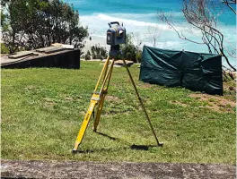
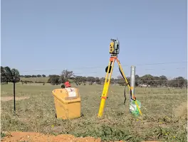
Our boundary surveys precisely define property lines using advanced GPS and robotic total station technology. This service ensures legal compliance for land subdivisions, developments, and dispute resolution. Clients benefit from accurate documentation recognized by NSW land authorities.
Construction Set Out
We provide precise construction set-out services for buildings, roads, and infrastructure projects. Using digital modeling and field controllers, we translate design plans into physical markers on-site. This ensures alignment accuracy and reduces costly rework during construction phases.
3D Laser Scanning
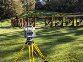
Our Trimble X7 laser scanners capture detailed 3D models of structures and landscapes. This technology supports BIM integration, heritage preservation, and as-built documentation. Clients receive high-resolution data for efficient design and project management.
Drone Surveys
Equipped with Sensefly eBee drones, we conduct aerial surveys for large-scale land mapping. This service delivers topographic data, volumetric calculations, and progress monitoring for construction and mining projects. It offers cost-effective coverage of challenging terrains.
Topographic Surveys
We create detailed topographic maps showing natural and man-made features. These surveys support urban planning, environmental assessments, and engineering designs. Clients receive CAD-ready deliverables with elevation contours and feature annotations.
People
Mike Morris
Principal Director
Mike Morris is a NSW Registered Land Surveyor with over 30 years of experience. He leads Citisurv's technical operations and holds CASA accreditation for UAV operations. His expertise spans mining, civil engineering, and cadastral surveys.
Questions
What surveying services does Citisurv offer?
We provide boundary surveys, construction set-outs, 3D laser scanning, drone mapping, and topographic surveys for residential, commercial, and government clients.
How long has Citisurv been in business?
Citisurv has operated since 2007, incorporating Starr Surveying established in 1972. We have over 50 years of combined industry experience.
Which areas do you service?
We cover Sydney, Wollongong, Newcastle, the Central Coast, Blue Mountains, and surrounding regions in New South Wales.
What technology do you use?
We utilise Trimble GPS systems, robotic total stations, UAV drones, and laser scanners to ensure precision and efficiency in all surveying tasks.
Can you handle large-scale projects?
Yes, we've successfully completed major projects like the M4 Smart Motorway upgrade and Nepean Business Park developments using advanced methodologies.
How do you ensure client satisfaction?
We offer free proposals, fast turnaround times, and maintain open communication throughout projects to meet client expectations and deadlines.
Reviews (3)
Buildlife Projects
Oct 02, 2018
Report
Very happy with the services of Citisurv. The whole team has been outstanding in delivering our projects in Penshurst and Riverwood from start from finish; detail, setout, DP and strata plan. I'd like to thank our surveyor Taha for his professionalism and prompt service. Highly recommend Citisurv as your go-to surveying team.
Bilal Allouche
Jul 19, 2018
Report
Mike from Citisurv is one the best surveyors in the business. He is always very professional, always courteous and willing to go the extra mile. Mike has been there for us in the good and hard times and has never let us down. Big thank you to Mike and the Citisurv team, looking forward to working with you on all my future projects. A+
Andalos Developments
Sep 30, 2017
Report
Our experience with Citisurv has so far been excellent. Ismat has been very responsive and helpful with all our requests and has gone above and beyond to ensure we meet deadlines and that submissions are all done without error or hiccups. Ismat and the Citisurv team are true experts in their field, highly recommend to all builders & developers alike. Look forward to working for years ahead - Alamir Ayoubi