
Business Details
16 Years
experience
Your Trusted Land Surveyors in ACT and NSW
STEGER & ASSOCIATES Registered Land Surveyors has been delivering expert land surveying services across the Australian Capital Territory and New South Wales since 2010. Our team of qualified professionals brings over two decades of combined experience to every project, utilising cutting-edge technology to ensure precision and reliability. We specialise in boundary, topographic, engineering, and construction surveys, supporting both government and private sector clients with tailored solutions. Our commitment to professionalism, transparency, and attention to detail ensures every project starts on a solid foundation. We pride ourselves on staying at the forefront of industry advancements, offering services such as 3D laser scanning, UAV/drone mapping, and bathymetric surveys.With a focus on client satisfaction, we work closely with stakeholders to understand unique requirements and deliver results that exceed expectations. Our reputation as industry leaders is built on a track record of successful projects across residential, commercial, and infrastructure sectors. We adhere to strict quality assurance protocols, ensuring accuracy and compliance with regulatory standards. Our values of integrity and excellence guide every aspect of our work, from initial site investigations to final documentation. Whether supporting small-scale developments or large infrastructure projects, we provide cost-effective, reliable solutions that set projects up for success.
Services
Boundary/Subdivision
Topographic/Detail
Engineering
Construction
Commercial
Residential
Roads
GNSS
3D Laser Scanning
UAV/Drone
Details
- Year established: 2010
Highlights and features
- We have over 20 years of combined experience in professional land surveying.
- We utilise the latest technology for accurate and efficient surveying solutions.
- Our team specialises in both government and private sector projects.
- We maintain strict quality assurance protocols for all surveying work.
- We offer tailored services for residential, commercial, and infrastructure projects.
Associations and certifications
- Telstra Accredited Surveyors
Services
Boundary/Subdivision
Our boundary and subdivision services include precise marking, site investigations, and plan preparation for residential and commercial developments. We handle projects from small boundary fencing to large-scale land divisions, ensuring compliance with legal and regulatory standards. Our detailed documentation supports smooth approvals and project execution.
Topographic/Detail
We create detailed topographic plans with spatial data tailored for master planning and development projects. Our surveys capture terrain features, structures, and utilities to support accurate design and construction. Deliverables are provided in preferred formats for seamless integration with client workflows.
Engineering
Our engineering surveys provide spatially accurate data for built environment designs, including metadata for project planning. These surveys ensure precise alignment of infrastructure elements, supporting efficient construction and reducing rework risks for clients across public and private sectors.
Construction
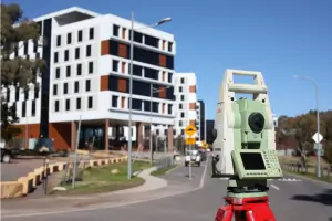
We conduct thorough construction surveys for residential, commercial, and multi-storey projects, ensuring quality assurance throughout the build process. Our team uses advanced tools to verify dimensions and alignment, helping clients avoid costly errors and delays during construction phases.
UAV/Drone
Our UAV/drone services offer efficient site monitoring, terrain modelling, and ortho-rectified imagery. We combine aerial and ground surveys for hybrid solutions, providing cost-effective data collection for large or complex sites while maintaining high accuracy standards for project stakeholders.
Questions
What surveying services do you offer?
We provide boundary, topographic, engineering, construction, commercial, residential, road, GNSS, 3D laser scanning, UAV/drone, utility investigation, and bathymetry surveys.
Which areas do you service?
We operate throughout the Australian Capital Territory and New South Wales regions for both government and private sector projects.
How experienced is your team?
Our team has over 20 years of combined experience in land surveying, using the latest technology and industry best practices for accurate results.
Do you offer emergency surveying services?
We do not provide emergency services but prioritise timely responses for urgent project requirements during standard operating hours.
What technologies do you use?
We utilise GNSS, 3D laser scanning, UAV/drone mapping, and other advanced tools to deliver precise, efficient surveying solutions for all project types.
Reviews (1)
Jarek Miliszewski
Nov 25, 2020
Report
Positive:Professionalism,Quality,Responsiveness,Value
Jason Steger and team supplied our boundary survey, site pegging and supporting site sketch. The team was friendly, professional, on-time, and well priced. Highly recommended.
Jason Steger and team supplied our boundary survey, site pegging and supporting site sketch. The team was friendly, professional, on-time, and well priced. Highly recommended.