
Business Details
22 Years
experience
Your Trusted Surveying Partner in Perth
Founded in 2004 by Clayton Austin, our company was established on principles of professionalism and work ethic. We specialise in land, construction, and engineering surveys for commercial and residential developments across Perth and regional Western Australia. Our team utilises cutting-edge technology to deliver precision in projects ranging from multi-million-dollar engineering works to small private developments. Integrity forms the cornerstone of our operations, ensuring uncompromised work ethic and professional values.We guarantee quality service through continuous improvement in methodologies and equipment. Innovation drives our approach, from advanced UAV solutions to 3D laser scanning capabilities. Our safety protocols maintain a perfect record in worker, client, and public safety. With over 18 years of experience, we combine historical surveying expertise with modern technological advancements to provide tailored solutions for complex projects.
Services
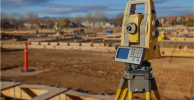
Engineering Surveys
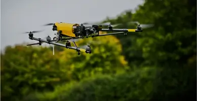
Aerial Inspections
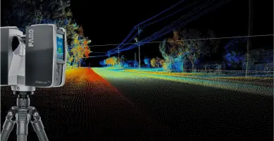
3D Laser Scanning
Land Subdivisions
Boundary Surveys
Details
- Year established: 2004
Highlights and features
- We have over 18 years of experience in Western Australian surveying projects
- Our team uses advanced 3D laser scanning and UAV technology
- We maintain a perfect safety record across all projects
- Our services cover complete land development cycles from feasibility to lodgement
- We combine historical surveying expertise with modern innovation
What people say
Excellent plans
Professional service
Reliable and professional
High standard of service
Prompt approvals
Services
Engineering Surveys
Our engineering surveys utilise the latest technology for precise data acquisition in construction projects. We specialise in boundary determination, site establishment, and as-built documentation. Our services ensure compliance with regulatory requirements while maintaining accuracy within 2mm for critical infrastructure projects.
3D Laser Scanning
We provide high-resolution 3D laser scanning services capturing up to 1 million points per second. Our scanners create detailed point clouds for asset management, design verification, and heritage preservation. Deliverables include BIM models, 2D drawings, and interactive 3D visualisations accessible via web platforms.
Land Subdivisions
Our subdivision services cover the complete development cycle from feasibility studies to final plan lodgement. We handle freehold subdivisions, strata titles, and land amalgamations. Our team manages council negotiations, topographic surveys, and sales plan preparation to maximise lot yield and development efficiency.
Aerial Surveys
We conduct aerial surveys using UAV technology for mapping and infrastructure inspection. Our drones capture high-resolution imagery and geospatial data for topographic mapping, stockpile volume calculations, and construction progress monitoring. This method reduces field time by up to 60% compared to traditional methods.
Boundary Surveys
Our licensed surveyors perform boundary re-establishment and cadastral surveys with historical accuracy. We use digital records and field measurements to resolve property disputes and prepare plans for land transactions. All surveys comply with Landgate standards and include detailed legal descriptions.
People
Clayton Austin
Founder & Director
Clayton Austin established the company in 2004 with over 18 years of surveying experience. He specialises in complex land development projects and maintains active involvement in technical operations. His expertise includes boundary resolution, subdivision planning, and construction surveying.
Questions
What surveying services do you offer in Western Australia?
We provide engineering surveys, 3D laser scanning, aerial mapping, land subdivisions, and boundary surveys across Perth and regional WA using advanced technology.
Are your surveyors licensed and accredited?
All our principal surveyors hold current Western Australian licensing with regular professional development. We maintain industry-standard equipment calibration certifications.
How do you handle complex land development projects?
We manage projects from feasibility through to plan lodgement, including council negotiations, topographic surveys, and subdivision applications compliant with WAPC requirements.
What technology do you use for surveying tasks?
We utilise UAV drones, 3D laser scanners capturing 1 million points/second, and digital total stations with ±2mm accuracy for comprehensive data collection.
Can you assist with both commercial and residential projects?
Yes, we handle projects ranging from small residential subdivisions to large-scale commercial developments with tailored surveying solutions.
Videos