Business Details
19 Years
experience
Your Trusted Land Surveying Experts in Thomastown & Diamond Creek
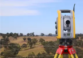
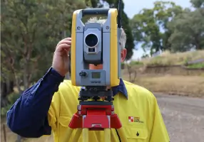
Established in 2007, Lewis Land Surveying has built a reputation for delivering precise and reliable land surveying services across Victoria. Our team, led by Licensed Surveyor Leighton Lewis with over 25 years of industry experience, utilises cutting-edge Trimble robotic total stations, GPS equipment, and advanced CAD software to ensure accuracy and efficiency. We serve a diverse clientele, including architects, developers, and construction firms, while maintaining strong relationships with local councils and authorities.Our commitment to quality extends to both technical excellence and client collaboration, as demonstrated through our involvement in post-bushfire boundary re-establishment projects. With offices in Thomastown and Diamond Creek, we combine local expertise with statewide capabilities to meet the evolving needs of Melbourne's growth corridors and regional areas.

Services
Title Boundary Surveys
Subdivisions
Building Set-outs
Feature & Level Surveys
Civil Engineering Surveys
Planning Permit Applications
Easement Creation
As-built Surveys
Adverse Possession Applications
Details
- Year established: 2007
Highlights and features
- We have over 25 years of experience in Victorian land surveying
- We use Trimble robotic total stations and GPS equipment for accuracy
- Our team manages subdivisions from council liaison to final plans
- We operate across Melbourne's growth corridors and regional Victoria
- We contributed to post-bushfire boundary re-establishment in Kinglake
Services
Title Boundary Surveys
Our licensed surveyors precisely re-establish property boundaries using digital equipment and historical records. This service supports fence replacements, property sales, and development applications across urban and rural Victoria. Clients receive detailed plans compliant with Victorian cadastral standards.
Subdivision Planning
We manage subdivision projects from initial concept to final plan registration. Our team coordinates with councils and referral authorities to ensure compliance with planning permits and infrastructure requirements. Services cover residential estates and commercial developments across Melbourne's growth areas.
Building Set-outs
Using robotic total stations, we establish accurate building footprints and elevation benchmarks for construction projects. This service ensures structures align with approved plans and building regulations across residential, commercial, and industrial sites.
Feature & Level Surveys
We create detailed 3D site models showing natural and man-made features. These surveys support drainage analysis, design planning, and construction documentation for projects ranging from small developments to large infrastructure works.
Civil Engineering Surveys
Our team provides survey support for road, drainage, and utility projects. Services include design verification, as-built documentation, and compliance checks using GPS and laser scanning technology for municipal and private engineering works.
People
Leighton Lewis
Licensed Surveyor & Founder
With over 25 years' experience, Leighton leads survey operations using Trimble equipment and CAD software. He holds a Bachelor of Land Information from RMIT and maintains registration with the Surveyors Registration Board of Victoria.
Michelle Lewis
Project Manager
Michelle manages subdivisions and client relations, leveraging her cartography degree from RMIT. She coordinates council approvals and ensures efficient project delivery for residential and commercial developments across metropolitan and regional Victoria.
Questions
What areas do you service?
We operate across greater Melbourne, the Mornington Peninsula, and regional Victoria, with offices in Thomastown and Diamond Creek.
Are you registered surveyors?
Yes, Leighton Lewis is a Registered Licensed Surveyor with the Surveyors Registration Board of Victoria and member of the Institute of Surveyors.
What survey equipment do you use?
We utilise Trimble robotic total stations, GPS systems, and advanced CAD software for accurate data collection and plan production.
Can you handle subdivision projects?
Yes, we manage subdivisions from council liaison to final plan registration, including planning permits and infrastructure compliance.
How do you handle bushfire-affected properties?
We re-establish boundaries and conduct feature surveys for rebuilding in fire-affected areas like Kinglake, with post-2009 bushfire recovery experience.