
Business Details
9 Years
experience
Professional Land and Engineering Surveyors in Perth
Established in 2017, LPD Surveys has grown from a local Mandurah operation to a multi-office team serving all of Western Australia. Our foundation in land and engineering surveying has been strengthened through strategic partnerships and acquisitions, including the integration of Driscolls Land Surveyors in 2023. With over 80 years of combined experience across our leadership team, we deliver precision and innovation in cadastral, engineering, mining, and 3D reality capture surveying. Our investment in cutting-edge technology, including UAV drones and laser scanning systems, ensures we meet modern industry demands. We maintain ISO 9001 standards through rigorous quality assurance processes and a commitment to continuous improvement.Our team of licensed surveyors and engineering professionals brings expertise from diverse sectors including mining, infrastructure, and residential development. We prioritise client collaboration through secure cloud-based project management tools for transparent communication. Our regional presence in Perth, Mandurah, Kalgoorlie, and Bridgetown enables comprehensive coverage of urban and remote locations. We uphold safety as a core value through comprehensive training programs and zero-harm initiatives. Our long-standing relationships with tier 1 contractors and government agencies demonstrate our industry reputation. We invest in mentoring cadet surveyors to maintain professional standards for future generations.
Services
Land Surveying
3D Reality Capture
UAV Aerial Surveys
Engineering Surveys
Mining Surveys
Land Development
Subdivision Services
Laser Scanning
As-Built Surveys
Geodetic Control
Details
- Year established: 2017
Highlights and features
- Over 20 years of combined experience in land surveying across WA
- ISO 9001 certified quality management systems
- Advanced 3D laser scanning and UAV drone technology
- Proven track record with tier 1 mining and infrastructure clients
- Comprehensive regional coverage from four Western Australian offices
Associations and certifications
- ISO 9001
- CASA ReOC
- RePL
What people say
Highest standard
Timely results
Experienced team
Complex projects
Quality deliverables
Services
Land Surveying
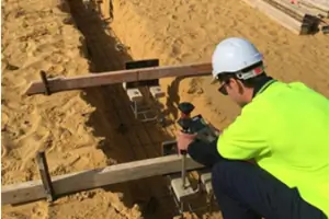
Our licensed surveyors provide precise boundary determination and property mapping services. Utilising advanced total stations and GPS systems, we deliver accurate cadastral surveys for land subdivisions and development projects. Our team maintains strict calibration standards to ensure measurement reliability across urban and remote locations in Western Australia.
3D Reality Capture
We create detailed 3D models using terrestrial laser scanning and UAV photogrammetry. Our sub-centimetre accuracy point cloud data supports BIM integration and infrastructure documentation. This technology enables efficient asset management and design validation for construction and mining clients across Western Australia's diverse terrain.
UAV Aerial Surveys
Our CASA-certified drone operations capture aerial data for topographic mapping and site monitoring. We process UAV-collected information into digital surface models and volumetric calculations. This technology enhances survey efficiency for large-scale projects in mining, infrastructure, and environmental monitoring sectors.
Engineering Surveys
We provide comprehensive survey support for engineering projects including road upgrades and infrastructure development. Our services cover control surveys, set-out measurements, and as-constructed documentation. Advanced equipment ensures precision in feature/contour surveys and deformation monitoring for civil engineering applications.
Mining Surveys
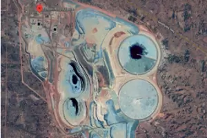
Our mining surveyors support exploration and production operations with DMIRS-approved tenement surveys. We deliver stockpile volume calculations, pit development monitoring, and infrastructure alignment surveys. With extensive experience in Pilbara and Goldfields operations, we provide critical spatial data for major mining companies across Western Australia.
People
Sam Keenan
Director and General Manager
Licensed Surveyor with 17 years' experience in mining and infrastructure projects. Specialises in remote operations and business development. Holds WA and NSW surveyor registrations. Leads major projects for tier 1 contractors across Australia.
Jake Lampard
Survey Manager
Founding director with 15 years' experience in 3D spatial projects. Specialises in UAV technology and land development. Mentors cadet surveyors towards professional licensing. Combines field expertise with strategic business management.
Victor Smith
Senior Licensed Surveyor
35+ years' experience in land development and strata subdivisions. Provides expert guidance on complex cadastral matters. Specialises in high-rise developments and regulatory compliance. Holds Curtin University qualifications and industry-recognised certifications.
Jack Alliss
Senior Development Manager
43 years' industry experience specialising in strata regulations and land subdivisions. Provides technical expertise on complex development projects. Former director of acquired surveying firm. Maintains deep knowledge of WA's land administration systems.
Cameron
Senior Surveyor
12 years' experience in cadastral and engineering surveying. Specialises in 3D reality capture and UAV technology. Produces survey-grade models using photogrammetry and lidar systems. Curtin University graduate with mining and infrastructure project expertise.
Questions
What does a subdivision surveyor do in Perth?
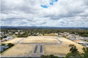
A subdivision surveyor legally divides land into separate lots while ensuring compliance with WA planning regulations and local council requirements.
How do I know if my property is suitable for subdivision?
We conduct feasibility studies assessing zoning, access, and services to determine subdivision viability according to local planning codes.
How long does the subdivision process take in Perth?
Typically 3-6 months including feasibility studies, survey work, and final approvals from relevant authorities.
What is included in a subdivision feasibility report?
Reports cover site analysis, zoning compliance, potential lot configurations, service availability, and cost estimates for development.
How accurate is your 3D scanning service?
Our terrestrial laser scanners deliver sub-centimetre accuracy for reliable point cloud data used in engineering and BIM applications.
Can you create 3D models from laser scanning data?
Yes, we convert point cloud data into accurate 3D models suitable for BIM integration and design validation processes.
Videos